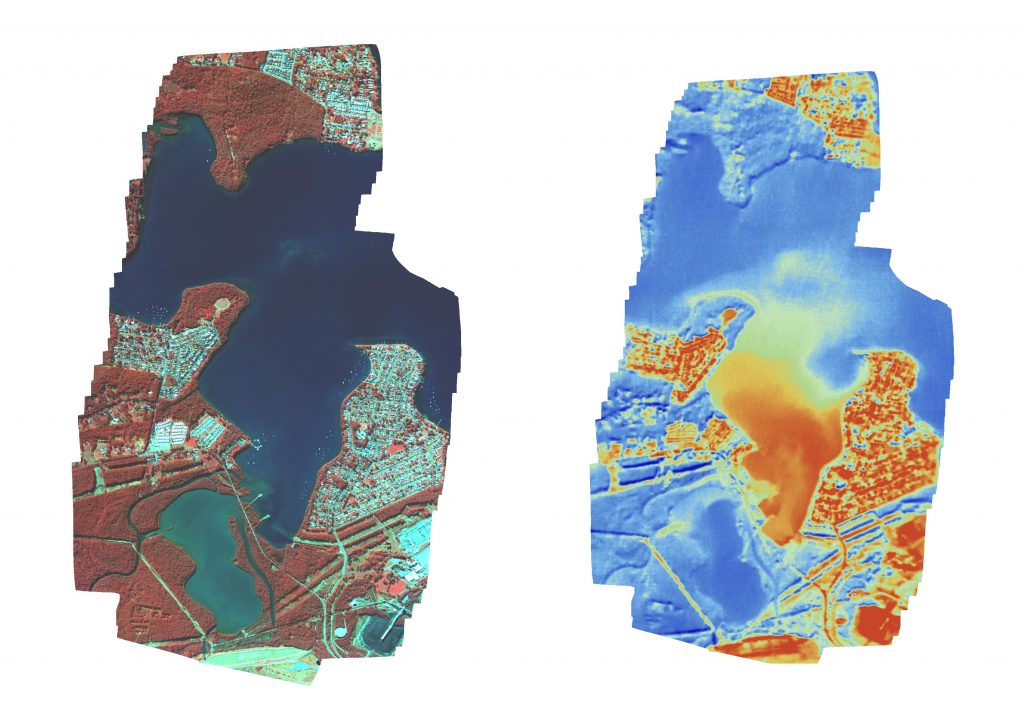
Are you chasing some multispectral or thermal imagery for your next GIS or environmental monitoring project? Is the area to big to cover with drones drones, or do you require higher resolution than satellite? Then at Xmap we may have the answer for you. Here is an example of an area we captured with one of our portable mapping systems at 50 cm GSD. It’s a bay of a NSW coastal lake, and the hot water discharge from a local power station can clearly be seen flowing in from the SE corner of the bay. Visible in the thermal mosaic (right) the plume of warmer water can be seen as it flows out of the bay and into the colder water of the surrounding lake. The false colour mosaic (left) shows infrared light displayed in the red channel. This results in healthy vegetation having a bright red colour. This is due to healthy vegetation reflecting high amounts of IR light.
Our multispectral pod is able to capture 5 spectral bands + thermal at resolutions ranging from 40cm to 2m GSD.