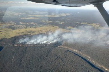
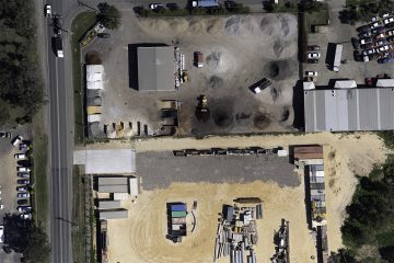
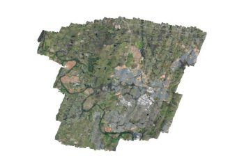
Why We Are Different?

The key areas that set Xmap apart from our competition are our flexible ‘On Demand’ approach to service delivery and the greater value for money our customers receive through the quality and economies of our portable mapping technology.

Portable Mapping Systems

Our STC approved portable mapping systems are designed in Australia for Cessna 172 aircraft. Our systems turn any Cessna 172 around Australia or the world into a survey aircraft. This means local aircraft can be utilised to conduct high quality surveys saving both time and money while reducing our carbon footprint.

HIGHLY EXPERIENCED TEAM

Our team has decades of survey experience and has logged thousands of aerial survey flight hours both across Australia and around the world. In addition to data capture we also provide data processing, and GIS services. Partnering opportunities are also available for those wanting to use our systems to capture their own data.

Australia Wide Data Capture

Using a network of portable mapping pods across Australia we are able to offer a nationwide data capture service. Our ‘On Demand’ services provide rapid data capture and turnaround times. Our products include high resolution Colour (RGB) photogrammetry, Thermal and Multispectral imagery.

Our Services

Using our portable mapping systems we can offer the following services Australia wide. Xmap operates under the AOC of Australian Aerial Services (AOC #: CASA.TAAOC.0453)
Airborne Thermography

Airborne Thermography

Unlike drones our thermal mapping pods are able to cover large areas quickly. With applications in mining, precision agriculture, environmental, and urban heat island mapping

Airborne Multispectral

Airborne Multispectral

Capturing image data that the eye fails to see at specific frequencies across the electromagnetic spectrum. Used for environmental monitoring, precision agriculture, and change detection

 Digital Surface / Elevation Models

Digital Surface / Elevation Models

Digital point clouds, elevation and surface models representing ground surface topography. Derived from high overlap photogrammetric methods.

Orthophoto Mosaics

Orthophoto Mosaics

Accurate GIS ready aerial imagery that has been geometrically corrected for topographical relief, lens distortion and camera tilt so the scale is uniform.

Portable Mapping Systems

Portable Mapping Systems

Our STC approved portable mapping systems are designed in Australia for Cessna 172 aircraft. Our systems turn any Cessna 172 around Australia or the world into a survey aircraft. This means local aircraft can be utilised to conduct high quality surveys saving both time and money while reducing our carbon footprint.

On Demand High Resolution Imagery

Meet the Xmap Team

Our Xmap team has decades of aerial survey and remote sensing experience worldwide. Meet our management team.
Erron Gardner

Erron Gardner

Photogrammetry & Remote Sensing

Erron has spent his career in aerial photogrammetry and remote sensing and is a well-known practitioner and consultant within the industry. He has a depth of experience in Australia and internationally in airborne data capture, processing and analysis, working with our customers to deliver optimised quality products.

Max Eichorn

Max Eichorn

Research & Development

Max has a background working with complex remote sensing systems including electro magnetic, magnetic and lidar systems in both fixed wing aircraft and helicopters as well as integration of small and medium format sensors into light aircraft capture systems. Max also has extensive experience as a survey pilot both in Australia and internationally.

Roger Brennan

Roger Brennan

Operations & Management

Roger is an experienced business manager who has worked across the globe in the US, Europe, Middle East, Asia Pacific and Australia. Roger’s background is in mechanical engineering, business systems and management. He is also a Commercial Pilot with significant aerial survey experience.

Blog

Display the latest posts on the front page.

2 cm GSD?

2 cm GSD imagery, must have come from a drone right? Nope this 2 cm data set was captured with one our portable mapping pods for Cessna 172 aircraft. Previously super high resolution imagery was Read more…

Get in Touch

Need more information about our systems or services, feel free to drop us a line?

Contact Us