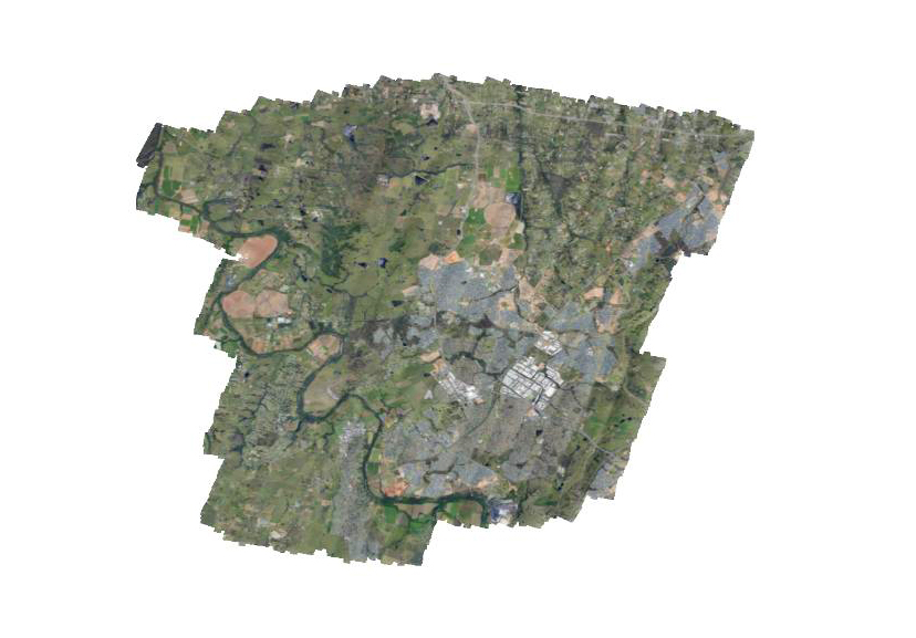
After some final bedding in flights our new large area survey system is now operational. Our camera system can be flown in economical single engine aircraft and allows high resolution data to be captured over large areas quickly and cost effectively. Pictured is one of our final test flights where we were able to capture 10 cm GSD imagery over an area of 210 sqkm in a little under two hours of aircraft time. As the data is captured with airborne GPS/IMU data this allows us to create spatially accurate mosaics with little or no ground control further reducing costs.
0 Comments