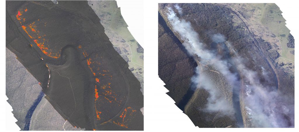
At Xmap we have been busy working on a fire mapping variant of our portable mapping systems. Our aim was to develop a low cost completely portable system that can be used to map small fires, as well as detect and map hotspots post fire. Images below are from a test flight over a hazard reduction burn in the Wilton area just out of Sydney a few weeks ago. Our system co-acquires both high resolution RGB (image on right) and thermal at the same time allowing for data fusion (left image).
0 Comments